The last Maps of Statistiken von morgen focussed on the distribution of the Map of tomorrow in Germany, but how far is it spread in the world? 89 of 245 ISO listed countries have at least one entry on the Map of tomorrow.
The following two Maps try to show the distribution.
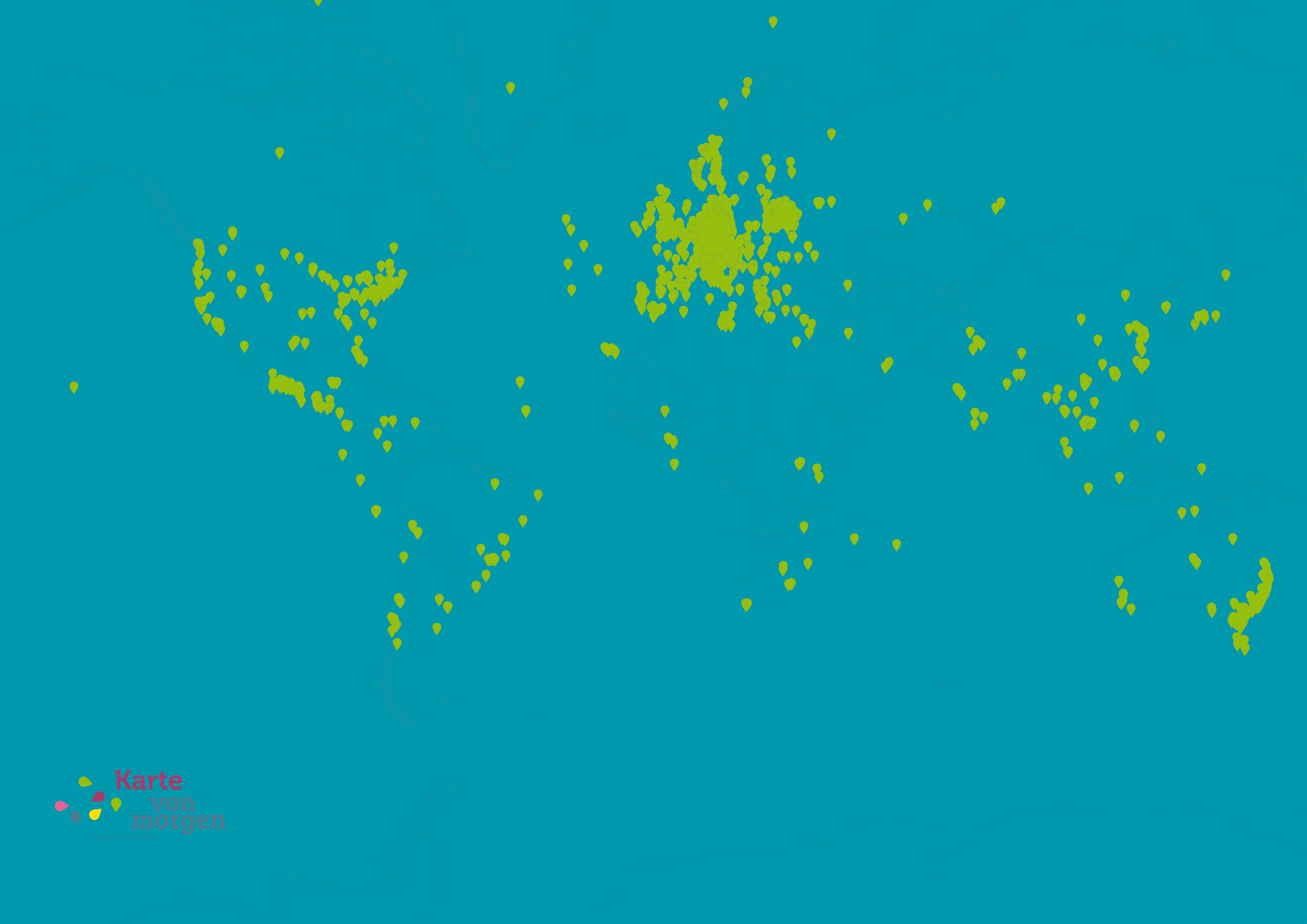
Can you locate yourself on a map, that only show the 23 000 entries from the Map of tomorrow?
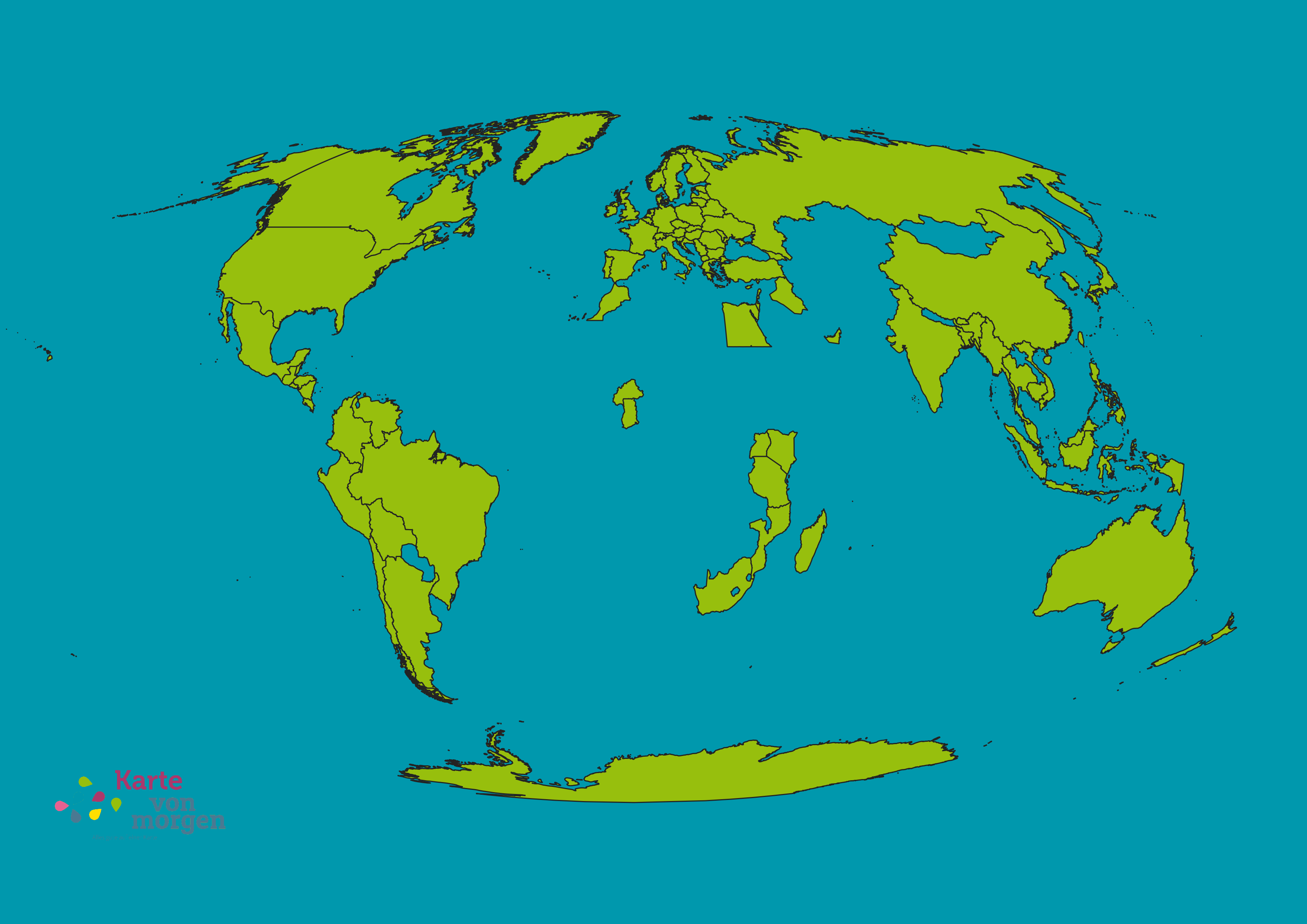
Or take a look on the following Map, that only shows countries with at least one entry on the Map of tomorrow
Maybe you have recognised, that the maps use different reference systems. The first Map is based on the Mercator Projection, which is maybe the most common Basemap for World maps and also standard for Webmapping applications. But it has a flaw: the size of the countries is wrong! Greenland for example is as large as the whole continent africa! The farther you go north or south from the equator, the bigger you will be on the Mercator Projection! The problem is that one cannot put the earths 3D surface on a planar surface. So maps can only truly show one of the three dimensions: angles, directions or area. Chose one and the others will be distorted. While worldmaps are used for navigation, the Mercator Projection is the right choice, as latitude and longitude have 90° and angles are correctly shown.
The second Map uses a Mollweide Projection. It is not recommended for navigation purposes as there is only one rectangle between latitute and longitute in the center of the map. But the areas are shown with their true size.
PS: I do not intend to spread an eurocentristic view on the world à la “sustainability made in germany”.
I want to show the size of the already extisting map of tomorrow network. Of course there are sustainable projects everywhere in the world. The map of tomorrow mainly focusses on the german-speaking countries and on the sustainablility that can be build here. It does not intend to map the whole world.